

This post is part of a series about our trip through Glacier and Waterton National Parks in July 2019. Although Glacier will begin partially reopening in June 2020 in the face of the COVID-19 pandemic, the information in our posts may not be accurate given the current conditions. We strongly encourage folks to check the park and lodging web pages for the latest park information. In particular, interpretive activities, dining, shuttle buses, and boating may be affected. Be sure to follow the principles of #RecreateResponsibly if you choose to visit this year.
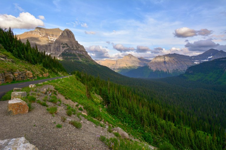
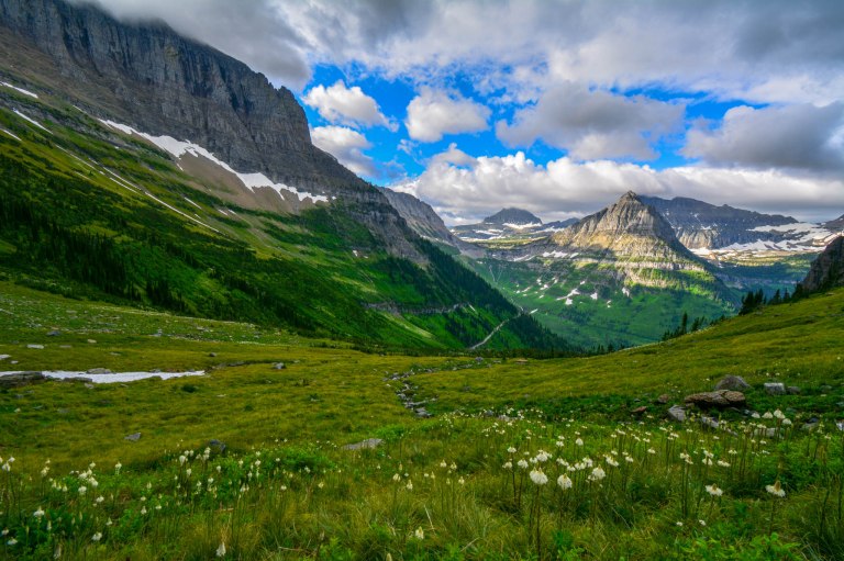
The Going-to-the-Sun Road is perhaps the most spectacular drive of any we’ve seen in a National Park, following the curved mountainscape and overlooking some beautiful natural features, including mountainous peaks, valleys, and waterfalls. The road runs from St Mary to West Glacier, and is the main artery through the park that allows access to some of the most iconic views and hikes. It is also of historical and engineering significance; it took over 20 years to build this roadway over the continental divide in the early 1900s.
We drove across the road about 7 times, and each time, as the light changed or we stopped at a different viewpoint, we were treated to another beautiful scene. It was also a really different experience to see the road from a park shuttle bus, equipped with huge windows for admiring the scenery. Even if you plan to drive, we’d strongly recommend taking a shuttle at least once if you’re able (be prepared to queue, as shuttles can get quite full during the day). If you take a shuttle from West-to-East, you’ll get awesome views if you can sit on the “passenger” side, opposite the driver.
To avoid heavy traffic times, we tended to drive the Going-to-the-Sun Road either right around sunrise or after dinner. Most of the pull-offs are on the south side of the road, so if you are traveling east-to-west, be careful as you have to turn across the road to park. Also be patient as you drive along the road – you never know when a bear or mountain goat may make an appearance!
In This Post
Below you’ll find a virtual tour along the Going-to-the-Sun Road, with some of our favorite stops from the trip, the mileage from St Mary, hike descriptions, and tips for when to try visiting. In light of the recent closure of the eastern entrances to the park, note that the Going-to-the-Sun Road will not run through the park in 2020, but will have a single point of entry and exit in West Glacier. To get the Mileage from West Glacier, subtract the mileage from St. Mary from 51 miles.
- Wild Goose Island Overlook
- Sun Point Nature Trail
- Jackson Glacier Overlook
- Hidden Lake Overlook
- Highline Trail
- Haystack Falls
- West Tunnel
- Avalanche Lake
- Lake McDonald
Wild Goose Island Lookout
- 7 miles from St. Mary
- Iconic view of Glacier’s peaks in a circle around a tiny island in St Mary Lake
- Time to visit: early or late
- Wear bug spray if you come late

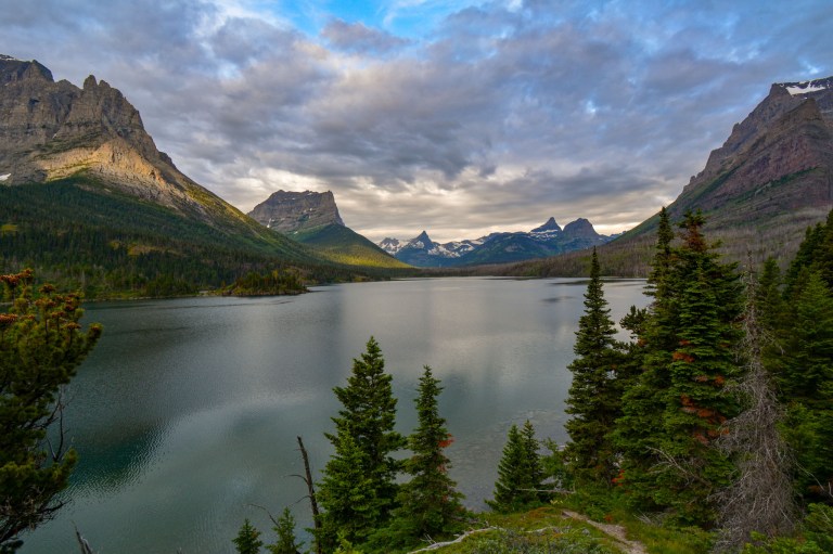
Wild Goose Island was our very first stop in the park. We arrived at our hotel in St Mary late one evening, right around sunset, so we thought we’d try our luck at the lookout (it’s only a 10 minute drive from the east entrance to the park). The sky can be absolutely gorgeous at sunset! If you plan to photograph the area late, be sure to take a tripod or steady your camera on a rock to capture all the colors sharply. Also, we got bitten by a bunch of mosquitoes at sunset, so we would recommend bringing long sleeves and bug spray if you go late.
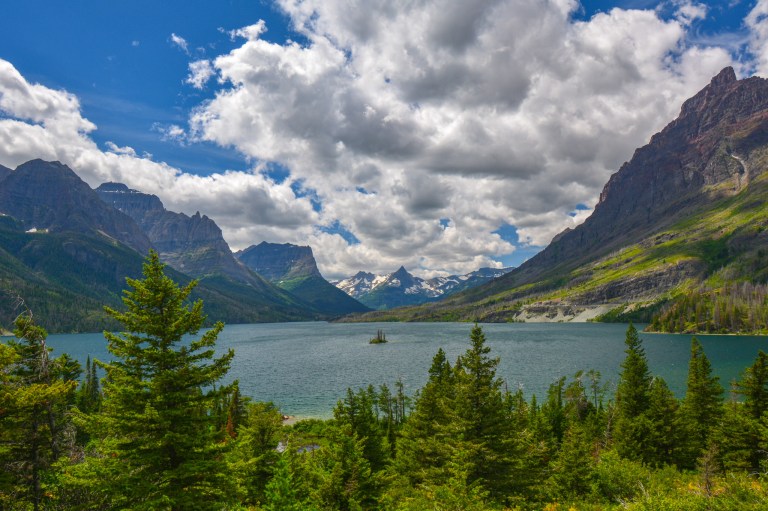
It was nice to revisit the area in the daytime to see the wonderful turquoise color of the lake. We had read that the island and surrounding peaks are best lit in the morning, which is true, since the island in the middle of St Mary Lake is southwest of the lookout point. There were plenty of parking spots in the evening, and we only had to wait a couple of minutes during the day.
Sun Point
- 10 miles from St. Mary
- Views of peaks rising over Mary Lake
- Time to visit: early
- Nature trail and scramble on large rocks (1.6 mi round trip to Sun Point)
If you are looking for a similar view as Wild Goose Island but from closer up, the Sun Point Nature Trail is a great bet. It was a little confusing for us to the find the path to Sun Point (it’s on the west side of the parking lot), but once we did, we followed the dirt path about 0.3 miles to an open rocky area with commanding views of the peaks around St. Mary Lake.

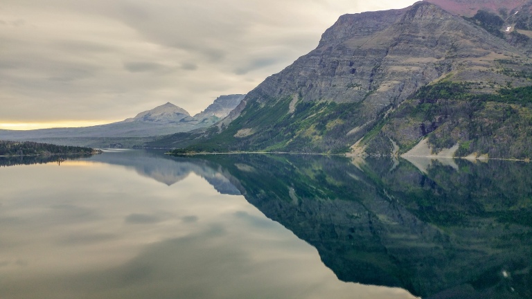
Even though the trail is short, it’s a little steep, and we took our time to walk all around the rocks here to soak in the peaceful scenery; budget at least an hour if you do wind up stopping here. A huge benefit of coming to Sun Point early was that the water on St. Mary Lake was very still in parts, providing spectacular reflections of the peaks in the area.
Jackson Glacier
- 13 miles from St. Mary
- A clear view to one of the 25 remaining glacier in the park
- Time to visit: anytime
- Roadside stop
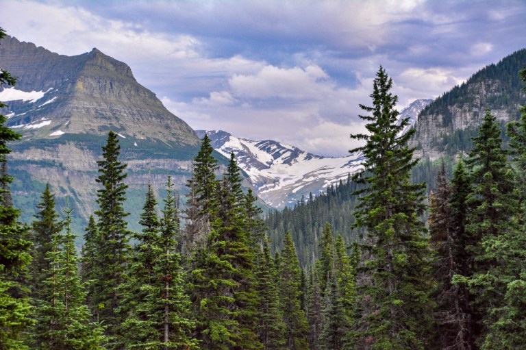
It’s worth making a quick stop at the Jackson Glacier Overlook – the glacier is the 7th largest in the park, the most visible from the road, and one of only 25 glaciers that remain in the park. An information sign talks about glaciers in general, how glaciers recede after ice ages, and how climate change has accelerated the pace of that change.
Logan Pass: Hidden Lake Trail
- 18 miles from St. Mary
- The high-point of the Going-to-the-Sun Road, along the continental divide
- Time to visit: early or late
- The trail to the Hidden Lake Overlook (2.7 miles roundtrip) gives great views and chances for wildlife sightings, but consider bringing traction devices
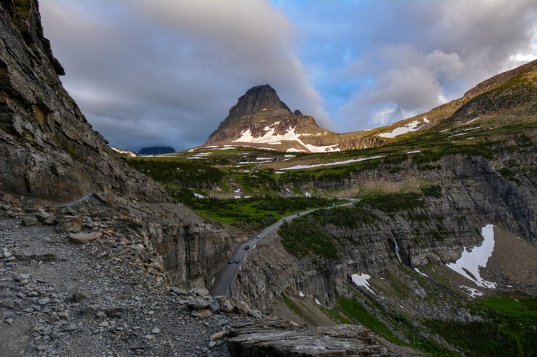
The Logan Pass Visitors Center marks the Continental Divide, the hydrological boundary in North America between water that flows into the Atlantic and Pacific oceans. While the parking lot can be completely full during the day because of hikers on long hikes (such as the Highline Trail — more on that in the next section), it is actually relatively easy to get a spot here around dinner time, and of course you can always elect to take the park shuttle.

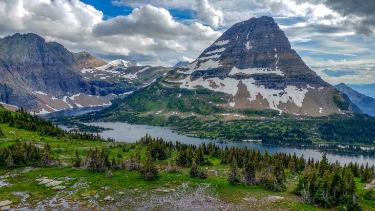
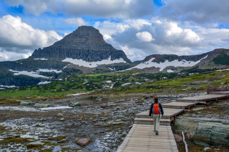
After our day at Many Glacier, we circled back to Logan pass for a hike to the Hidden Lake Overlook. It was a relatively easy route along a set of boardwalks and well-marked trails on the west side of Logan Pass. The boardwalks protect the fragile landscape of the meadows, so it’s very important to stay on the trail. Some of the trail sections to Hidden Lake Overlook were actually covered with snow during our walk, an ideal time to practice using our traction devices. The strap-on spikes that went over our hiking boots made it much easier and quicker to walk across these slippery sections of the trail.
While you can normally continue past the overlook down to the shores of the lake itself, that area was closed when we visited because of bear activity by the lake (it’s apparently full of fish, and thus a very popular spot for bears). Bears weren’t the only wildlife in the area: we saw ground squirrels, porcupines, marmots, and mountain goats!


Logan Pass: Highline Trail
- 18 miles from St. Mary
- A premier hike in the park travels along the garden wall above the Going-to-the-Sun Road
- Time to visit: before 7AM
- The Highline Trail can be done as a through-hike to the loop (11.8 miles one-way, ~5 hours), with an optional 1.8 mile round-trip extension to get a birds-eye view of the Grinnell Glacier
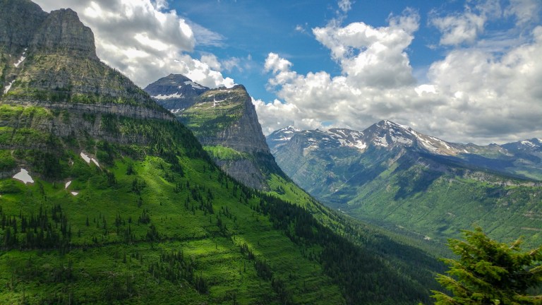
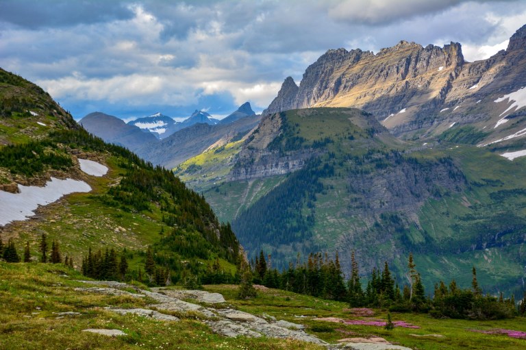
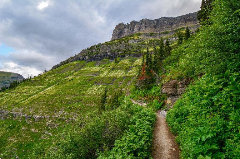
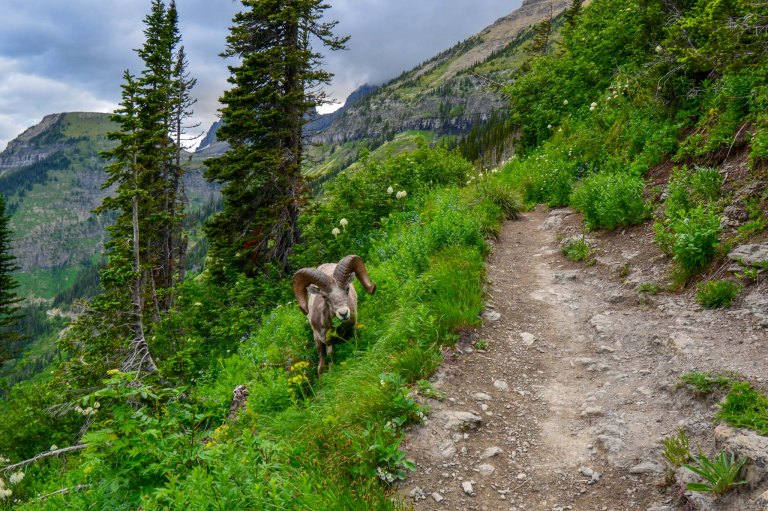
The Highline Trail follows the Continental Divide along the North side of the Going-to-the-Sun Road. We’ll never forget the fields of wildflowers, the bighorn sheep, and the views of endless peaks, valleys, and waterfalls that we had along this hike. It’s no wonder that it is one of the most popular long trails in the park. In order to secure a parking spot at Logan Pass, we’d strongly recommend arriving by 7:00AM. The parking lot was already over half full when we arrived around this time. Despite this, the trail never felt overcrowded or busy; we saw people just often enough to not be too scared of surprising a grizzly bear :).
We did this hike as a through-hike to “The Loop” on the Going-to-the-Sun Road, with the main hike being 11.8 miles (plan for ~ 5-6 hours). You can also do this as an out-and-back to any section of the trail you’d like, you can stay the Granite Park Chalet, or for the more ambitious, you can actually ascend over the Garden Wall and wind up in the Many Glacier area. To start this hike, we had to cross the Going-to-the-Sun Road to get to the Highline Trail. Pretty quickly, we started ascending above the road and had great views of Clements Mountain and the road over our shoulder.
Many blogs talk about the cable and narrow section of the Highline Trail about 0.25 miles from the trailhead. We didn’t find this section particularly scary or dizzying: if anything, the section immediately after the cables, when the trail seemed narrower, felt more daunting. Throughout the trail, we’d recommend walking closer to the rock face and focusing on your steps and not on the cliff faces if you ever start to feel anxious.
One you’re on the trail, the elevation change over the first 7 miles or so is pretty minimal, only a few hundred feet, which gives you the chance to really take in the views. The valleys to the left weren’t the only amazing sights along this trail: the wildflowers and waterfalls along the Garden Wall itself were really something to behold, and we even saw a bighorn sheep cross our path.

At the 6.9 mile mark, we took a spur trail to Grinnell Glacier Overlook that involved about 1000 feet of elevation change in less than a mile. Having been thwarted from seeing Grinnell Glacier the previous day by snow, we were keen to get a look at it, even if it meant climbing up a steep trail up to the ridge line.
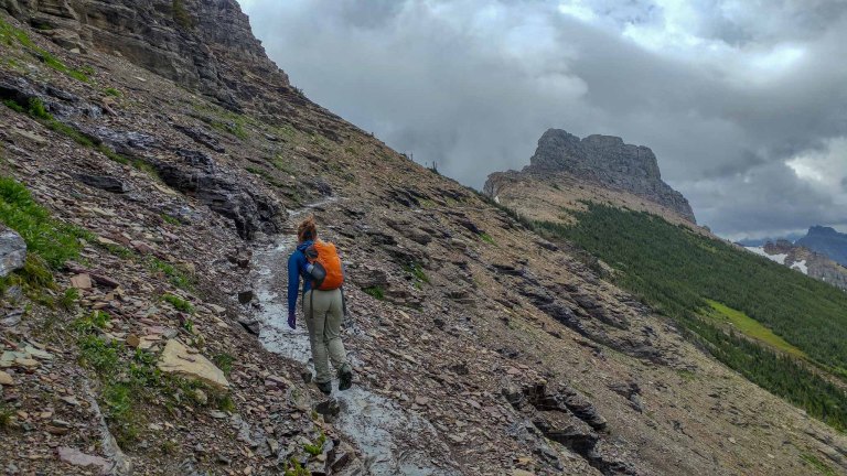
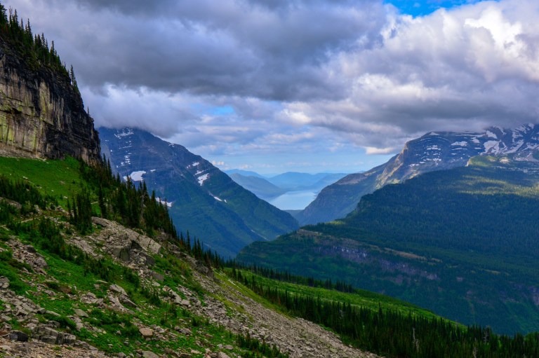
Although this segment was only 1.8 miles long, it took us almost an hour! Despite the hard workout, the somewhat slippery loose-rock trail, and the bitter wind waiting at the top, there were a couple of rewards for tackling this segment. First, of course, a view of Grinnell Glacier and the partially frozen Upper Grinnell Lake from the top.

The second reward was the view on the way back down, with a lake visible in among the peaks in the distance.
Very satisfied after this tough challenge, the Granite Park Chalet was a welcome sight about 0.7 miles after we got back down to the main Highline trail. The Chalet is a historic backcountry lodge built by the Great Northern Railway, but also a convenient place to take a breather and use the restroom before finishing out the hike.

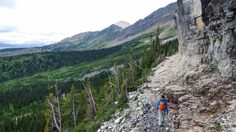
From the Chalet, it’s a pretty steep downhill hike back (~2500 feet of elevation loss over 4 miles) to the “Loop,” a hairpin turn in the Going-to-the-Sun Road. Though not at scenic as the first segment to Granite Park, the walk down to the loop is through a mix of forests (some burned out by fire) down to a bridge crossing a creek, with some nice peek-a-boo views long the way. We found walking downhill with trekking poles made this segment much easier on the knees.

After about 5.5 hours and 13.6 miles through breathtaking scenery, we were back at the loop! The tricky part now was catching a shuttle back to the car. Shuttles only reserve a couple of spots to pick up passengers at intermediate stops, like the loop, so you may have to wait for several buses to pass by before you grab a spot. We actually each snagged a spot on a different shuttle and made a plan to meet back at Logan Pass; this proved to be very efficient!
Haystack Falls
- 23 miles from St. Mary
- Get a glimpse of a clever piece of engineering
- Time to visit: anytime
- Pull out near “Bird Woman Falls” sign
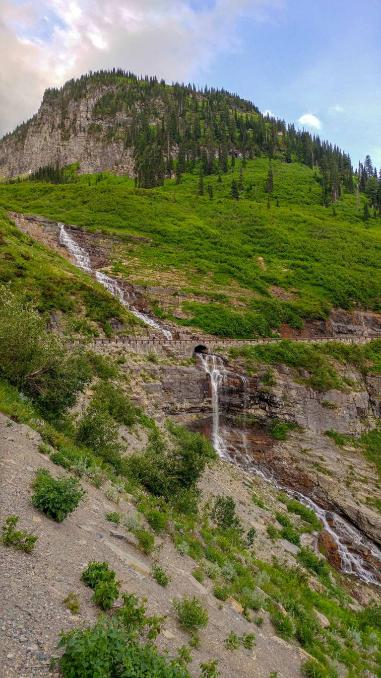
The unmarked and unnamed Haystack Falls tumbled down a set of terraces and right under a bridge the Going-to-the-Sun Road! Despite knowing about it, we didn’t get a good look at it until we knew where to stop! We’ve pinned the location in our map above, but a good reference point is to look for the “Bird Woman Falls” sign on the Going-to-the-Sun Road traveling from the Loop to Logan Pass. If you don’t make it to Haystack, don’t worry: as you drive across the road, you’ll see lots of other spectacular waterfalls!


West Tunnel
- 26.5 miles from St. Mary
- Neat framing of Heaven’s Peak through a tunnel
- Time to visit: anytime
- Pull out on the western side of the tunnel
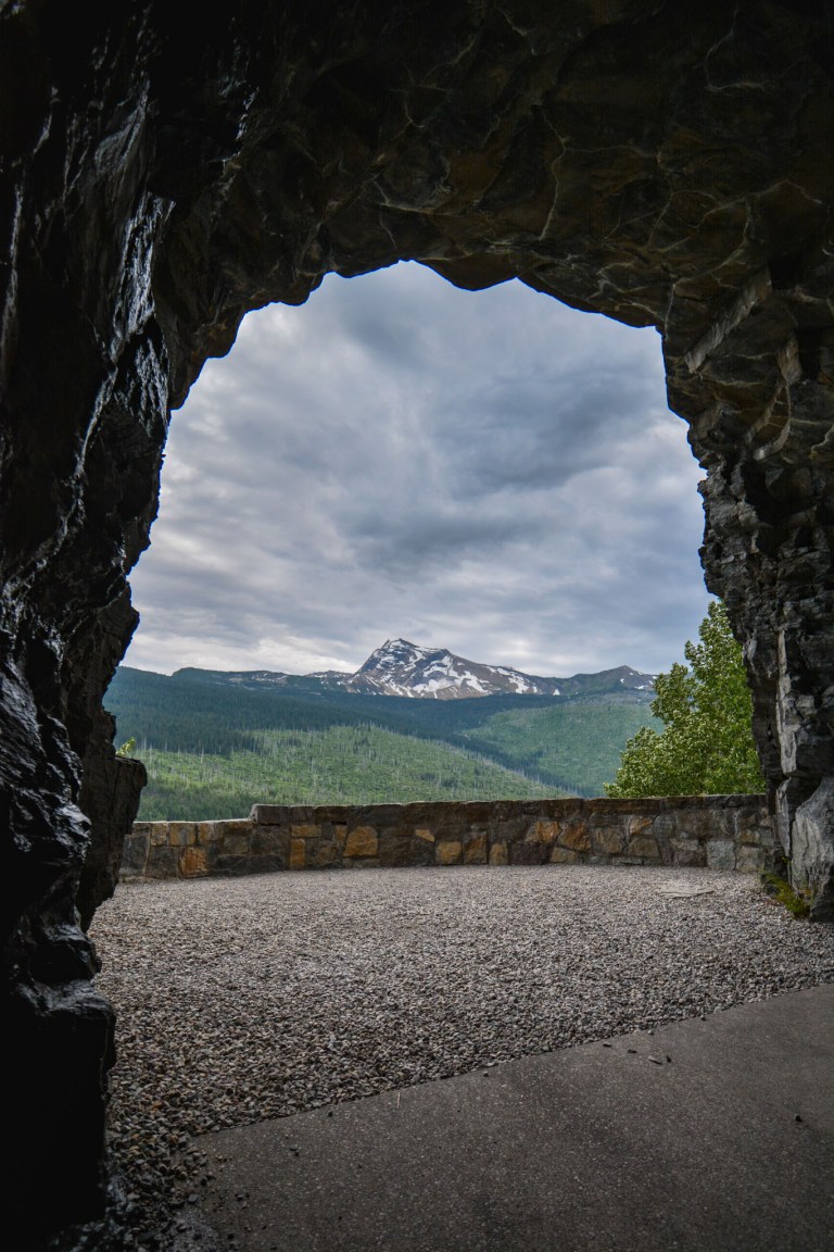
The shorter of the two tunnels along the Going-to-the-Sun Road, this one is unique because there are two viewing platforms outside the arches in the tunnel where you can view peaks in the Western part of the park. To get to the viewing platforms, it’s easiest to park if you’re traveling from east to west along the road. After you pass through the tunnel, there is a pull out on the right hand side (pinned in our map above). You can walk along the small path here that connects to the small sidewalk inside the tunnel.
Avalanche Lake
- 34 miles from St. Mary
- Lake fed by a chorus of waterfalls
- Time to visit: early (before 8AM)
- 4.5 mile hike by creeks and forests
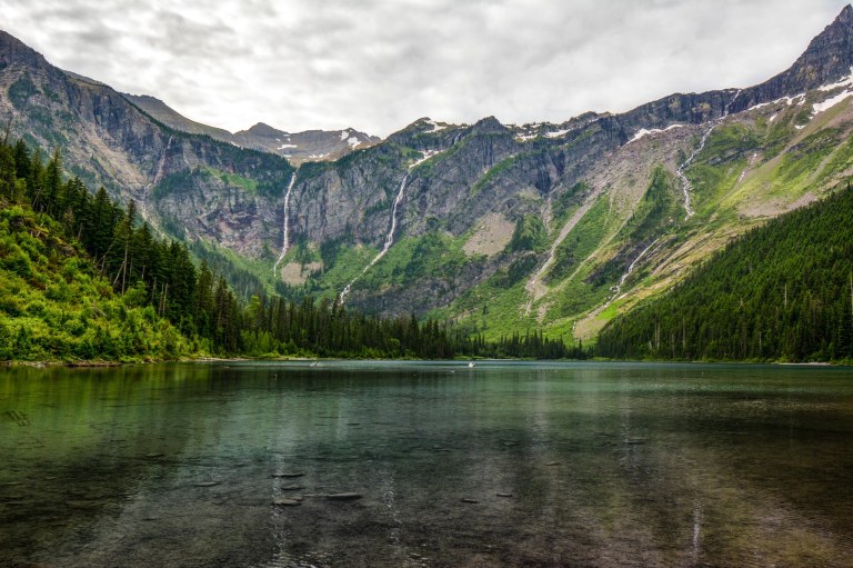
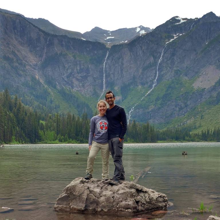
While in retrospect, Avalanche Lake is not a must-do, it is a very nice hike to a pretty epic lake surrounded by waterfalls, and so it’s pretty popular. We’d recommend arriving by around 8AM if you don’t want to hunt or wait for parking. Part of this 4.5 mile easy hike is along the Trail of the Cedars, one of only a couple of fully accessible trails in the park (Running Eagle Falls in Two Medicine is the other). As you can imagine, most of the views along the Trail of the Cedars, and even the trail beyond, are forested.
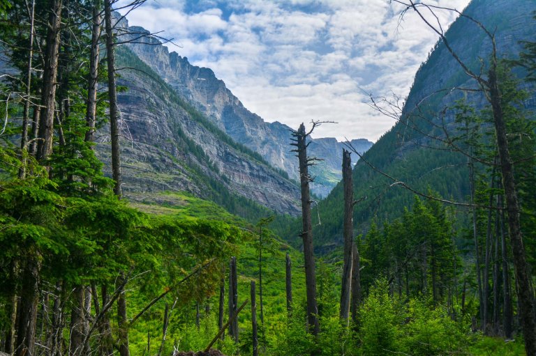
Avalanche is billed as a family-friendly hike in many guidebooks, but we saw more than one family complaining about the length of the hike, in part because it’s somewhat uneven terrain. Luckily, there are some neat features along the trail, including the rushing turquoise water of Avalanche Creek.
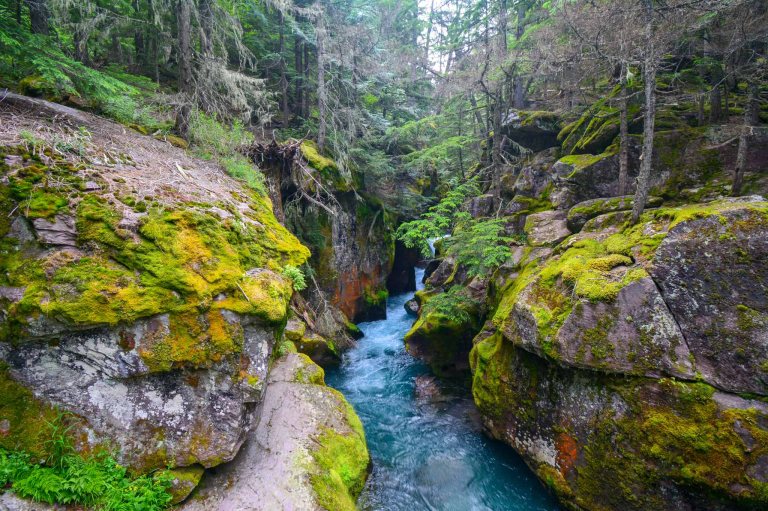
Photo tip: for a fun family portrait, once you get to the Lake, you can have someone take your picture while you stand on a flat rock by the lake shore.
Lake McDonald
- 40-48 miles from St. Mary
- The main hub for lodging, boating, and more, in the western part of the park
- Time to visit: anytime
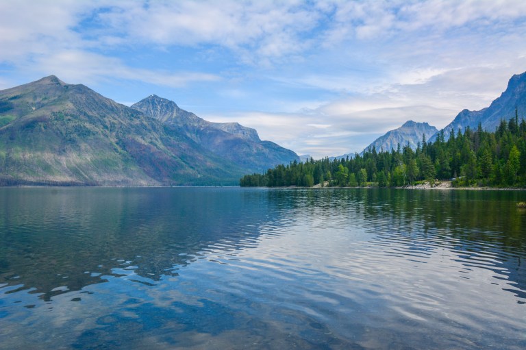
If you are looking for an area to relax with some creature comforts after a day of exploring in the park, Lake McDonald may be the place. You can grab a boat or SUP rental either at the Lake McDonald Lodge or Apgar Village, get an ice cream at Eddie’s in Apgar, or, like us, just enjoy the views by the side of the lake.
51 miles later, that ends our virtual tour of one of the most scenic routes in America! Do you have other favorite stops or hikes in this part of Glacier? Let us know in the comments below, and stay tuned for our next post about our trip to Waterton Lakes National Park, Glacier National Park’s Canadian Neighbor!

2 thoughts on “Glacier: Going-to-the-Sun Road and the Highline Trail”