

With emerald green hills, colorful wildflowers, and plenty of water after the rain in winter, parks and open spaces in the Bay Area take on a whole new complexion after the rainy winter season. Here are a few of our favorite spring hikes, along with some tips about the trails.
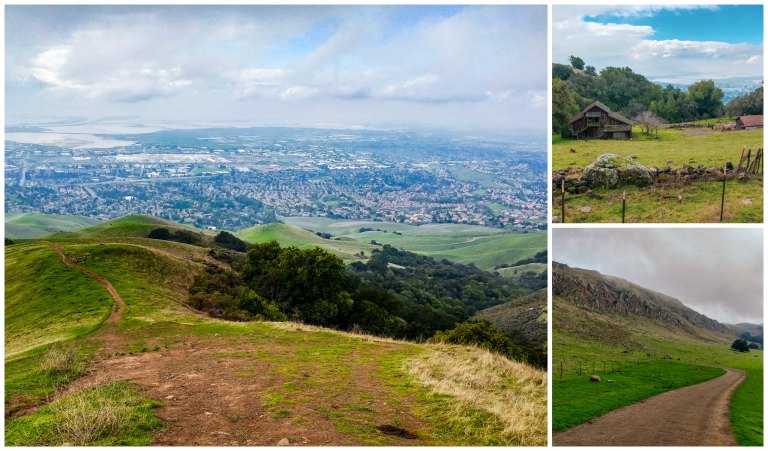
Alum Rock Park, San Jose
- Great views
- Good workout
- Windy
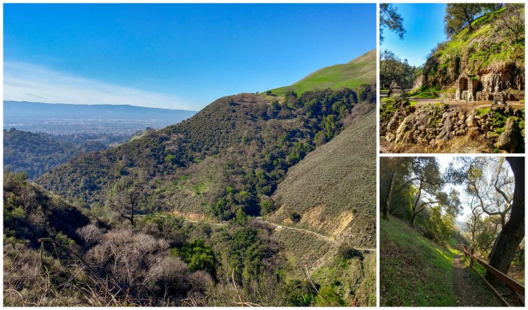
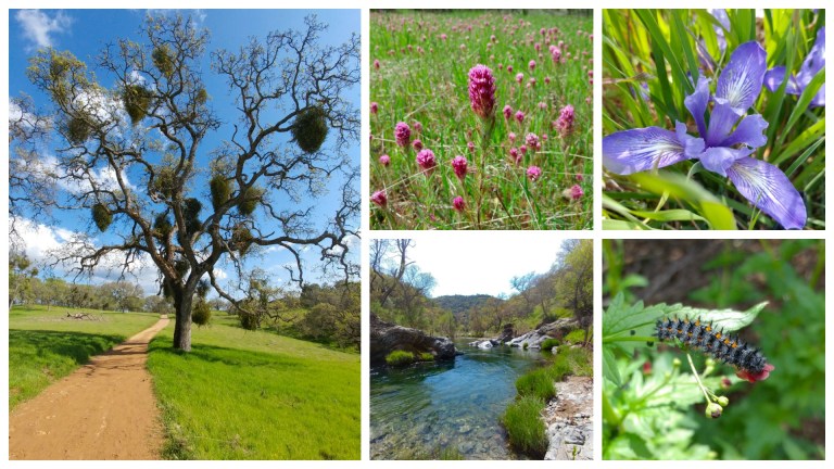
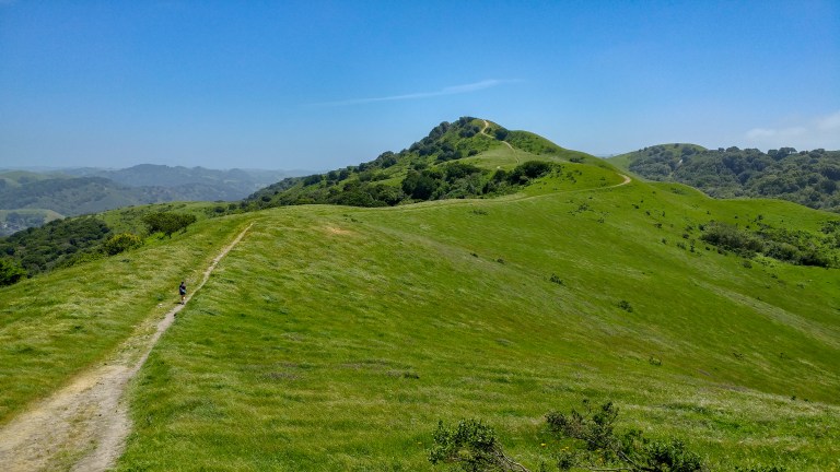
Alum Rock is the oldest municipal park in San Jose. The park has an interesting history as a health spa: you can still see stone structures from this era along with remnants of the Alum Rock Railway (which ran from downtown San Jose) when you visit the park. Although there’s no rail line anymore, the park is easily accessible from the South Bay, and you can take advantage of free parking if you park in the Eagle Rock and Rustic Lands parking lots.
We’ve done a few different trails in this park and we’ve really liked all of them! The clockwise path of the 4-mile South Rim Loop (photos above) takes you by the old mineral spa on the Penitencia Creek Trail before curving through a canyon and taking you up through an oak forest along a series of steep switchbacks. On the steep way down (either on the South Rim or Sycamore Switchbacks Trail), you’ll get great views of the green hills of the park.
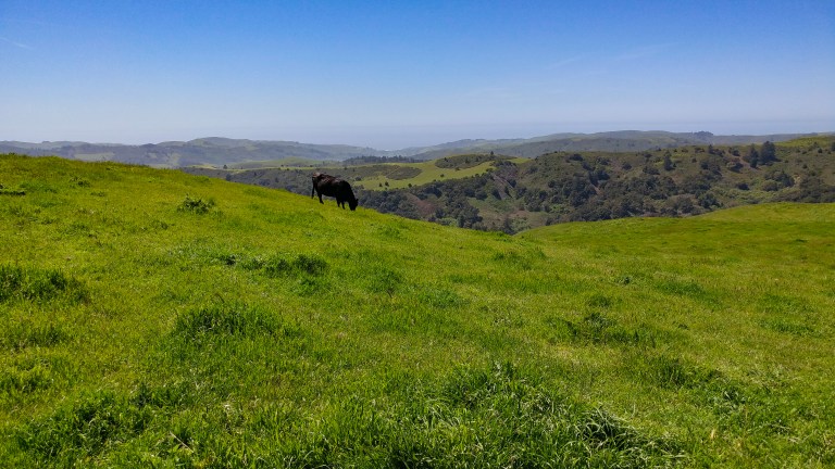
The 8-mile North Rim/Boccardo Loop (photos below) provides mostly exposed views of the green, carved hillsides and of San Jose, which can be quite dramatic in cloudy weather. During a particularly cold winter, we even saw some snow-capped peaks from the Sierra Vista staging area! In addition to cows, this is also the first park at which we’ve seen wild pigs running along the hillside. The elevation gain was just about perfect to give a good workout without being painful, but on a cold day the wind can be pretty brutal, so be sure to bring some layers.
Briones Regional Park, Lafayette
- Sun
- Gentle hills
- Cows
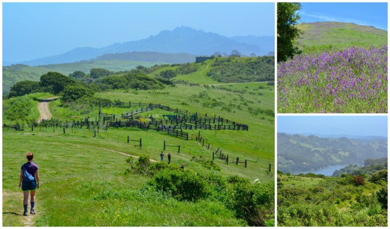
If you’re looking for a relatively easy hike, plenty of sun, and the opportunity to see some cows up close, check out Briones Regional Park near Orinda. The folks at Bay Area Hiker recommend a nice 4.4 mile balloon hike that takes you on a route through rolling hills out to the Briones Crest, with gorgeous views of the hills and seasonal lagoons in the park. There are a few different entrances in the park, so make sure you get directions to the Bear Creek Staging Area to park. When we visited in April last year, the trails were quite muddy, so be sure to wear good waterproof boots! There are also tons of cows that wander close to the trails on this hike, so we tried to be careful to avoid annoying them 🐄 .
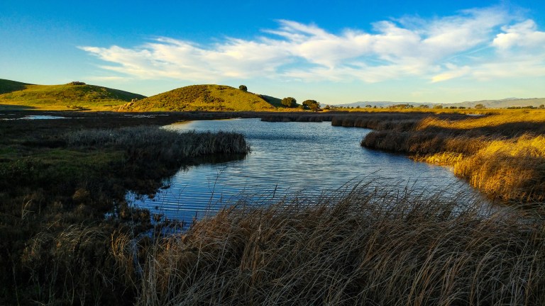
Coyote Hills Regional Park, Fremont/Newark
- Views of the Bay
- Good for groups
- Dog-friendly
- Stroller-friendly
- Wildflowers

Once, for Vijay’s birthday, we met friends for a lovely walk in Coyote Hills Regional Park. The park is great to get a big group together – there is plenty of paid parking near the visitor center past the park gate (don’t be fooled by the first few parking lots you see, especially the one before the main gate, which would require a big hike into the park!). We did the 3.5 mile loop along the Bay View Trail, which is almost entirely paved/on boardwalks, making it ideal for small children and strollers. The park is also dog-friendly as long as dogs stay on a leash. As you make your way along the trail, you’ll get absolutely fantastic views of the deep blue waters of the San Francisco Bay meeting the green hills, as well as interesting rock formations and marshes. We took the loop counter-clockwise, and the views were just phenomenal in this direction.
Ed Levin County Park, Milpitas
- Off-leash dog area
- Picnicking
- Ultra-clean bathrooms
Whenever we’re looking for an outing with dog-loving friends, Ed Levin County Park is one of our top choices. They have two off-leash fenced in dog areas (for little and big dogs, respectively) as well as a flat loop trail around Sandy Wool Lake and a more challenging set of trails that go up into the hills. There are some nice picnic tables around the lake, and you can watch people paraglide down the mountainside, too! A big bonus is that the bathrooms near the lake are spotless!
Henry Coe State Park, Morgan Hill
- Swimming
- Wildflowers
- Wildlife
Henry Coe State Park, near Morgan Hill, is the largest State Park in Northern California. Vijay took a day trip to this park with his friend Brian one year in April. Every trail was carpeted in wildflowers, water was flowing everywhere, and we saw wild turkeys, frogs, hawks, and many other creatures throughout the park. On a previous visit, Vijay, his sisters, and Ruth spotted a tarantula (the big spider is actually a symbol/mascot of the park).
We started at the Coe Ranch Visitor Center, which is accessible by driving as far east as you can go on Dunne Avenue in Morgan Hill. The main parking lot by park headquarters was totally empty when we arrived early on a Monday morning (in fact, the solitude was absolutely amazing during a weekday), but on weekends, you may have to park in an overflow lot further down the hill. There is running water and also clean flush toilets at the visitor center.
After exploring many of the park’s trails, we found that the effort to reward ratio was the best on the out-and-back hike (~ 10 miles round-trip, in blue on this map) to China Hole, which you can reach from park headquarters on the Corral and Springs trails, a short stretch through the Manzanita group camping area, and then the winding path on China Hole Trail. The views into the valley are amazing, the filtered light through the giant oaks and manzanitas is surreal, and the elevation change is substantial enough for the hike to be a good workout but not so steep as to be hard on the joints. There is also plenty of potable water and a couple of pit toilets along this direct path to China Hole, and even when it’s not warm outside, you can easily get dehydrated on this hike. If you’re feeling adventurous, consider swimming at China Hole. The water was crystal clear, albeit very cold, but it is very refreshing on a warm day.

If you want to make an extra-long day out of it (red trail on the map), start by heading to Frog Lake along the Monument Trail (you can visit the Henry Coe Monument on the way) and Hobbs Road to hear and see frogs and tadpoles swimming around before circling back and starting out to China Hole, for a total of about 13.5 miles. You could also combine these excursions into a grand loop, but we felt that the views from the Middle Ridge trail weren’t inspiring enough to justify the massive and sudden changes in elevation and the slowdown of multiple steam crossings.
Lower La Honda Creek Open Space Preserve, La Honda
- Sunshine
- Wildflowers
- A glimpse of the ocean
- Cows
This open space was established very recently; the upper La Honda Creek area requires a permit because of the limited parking space, but the lower area at the end of Sears Ranch Road doesn’t require a permit (and is free). We took the 6.4 mile out-and-back hike along the Harrington Creek Trail until the junction with the Folger Ranch Loop – we would have actually liked to go further, but we were blocked by a herd of cattle! Regardless, the trail was spectacular: lots of wildflowers, decent hills for beautiful vistas and a good workout, and an amazing view of the ocean!

Note that the drive along 84 is windy and features a mix of aggressive drivers, bicyclists, and blind curves, so although it adds some extra distance a drive along highway 35 (Skyline) was far less stressful for us. Even the parking lot here isn’t very large, but there were still plenty of spaces when we arrived in the early afternoon.
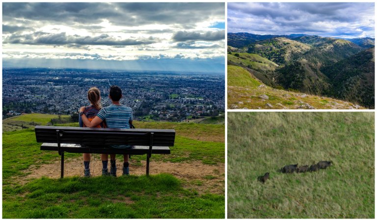
Mission Peak, Fremont
- Very steep climb!
- Green hills
- Cattle ranch
- Bay views
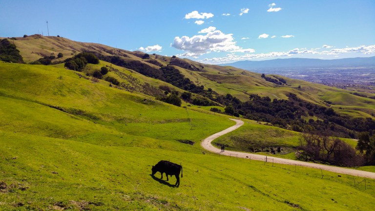
This park is not meant for a casual stroll… Mission Peak is on the NorCal Six Pack of Peaks challenge for good reason: with more than 2,000 feet of elevation gain in under 3 miles up, it’s a very steep ascent. Our first experience of the preserve in the summertime was pretty negative. The free parking at the Stanford Avenue lot is very limited (it’s nearly impossible to find a spot on the weekend), and parking in the nearby neighborhood or Ohlone College adds extra miles onto an already daunting challenge. The views of Fremont and the salt ponds are pretty consistent throughout, and the trail to get up to the peak at the end is extremely uneven and rocky and often very windy. In the summer, this hike is a hot, sweaty mess…
However, in the winter and spring, the park takes on a whole different character. Even doing part of the trail allows you to see grazing cows, ranches, interesting rock formations, reservoirs, and endless fields of green grass with much cooler temperatures. If you are able to get to the park on a weekday, even better, as you have a good shot of parking at the Stanford Avenue staging area.
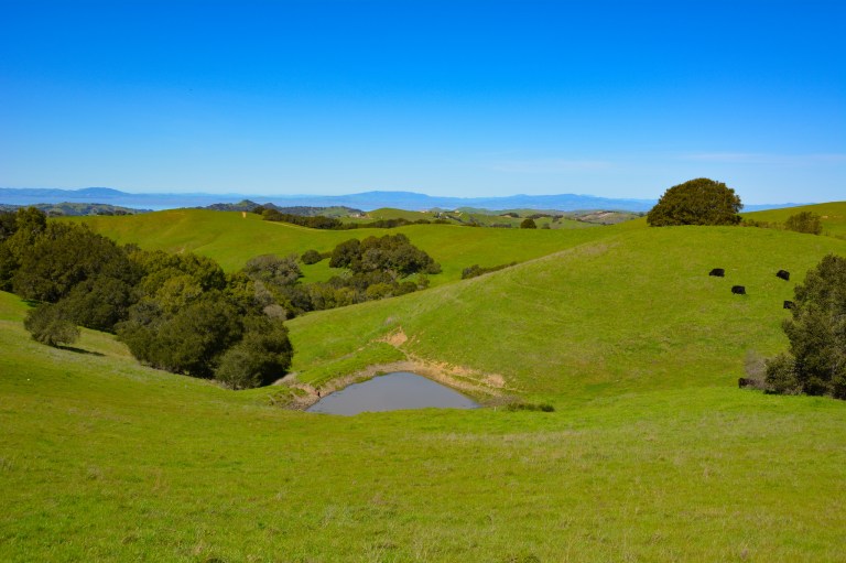
Morgan Territory Regional Preserve, Antioch
- Rolling hills
- Mount Diablo, bay, and reservoir views
- Wildflowers
- Dog friendly
- Cows
- Muddy after wet weather
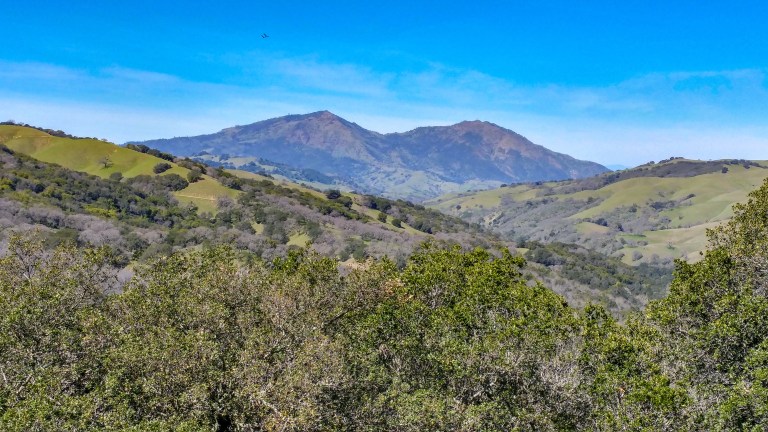
Morgan Territory regional preserve offers some of the best views of the East Bay parks with hardly any crowds. We parked at the Morgan Territory Road Staging Area and did an 8-mile loop clockwise through the rolling hills of the park. After a half mile of walking through a fairly shady area, we were treated to awesome views of Mount Diablo, the wind farms in the Montezuma Hills, and the Los Vaqueros reservoir as we made our way along the trail. We went in March, a little early for wildflower season, but the park is known for its colorful blooms. In early spring, the trail was super muddy in many places, and our waterproof hiking boots came in very handy!

Mount Tamalpais, Stinson Beach
- Coastal views
- Waterfalls
- A ladder

A very popular springtime trail in Mt. Tam State Park is the 7.3 mile Matt Davis/Steep Ravine Loop. Access to the park is free this way, but there is no parking lot to start this hike; instead, you’ll park somewhere near Belvedere Avenue in Stinson Beach, near the Fire Station, and then start off on the Matt Davis Trail. There are restrooms at the Pantoll Ranger Station, about midway through this hike, but be sure to bring plenty of water. On this hike, you’ll get awesome views of the ocean over your shoulder with nearly full exposure to the sun, followed by an interesting trek through a dense manzanita grove, a lovely stroll through coastal redwoods, and a ladder that will give you an up-close view of a waterfall :). Be sure to wear shoes with a good grip, and dress in layers for a variety of temperatures on this trail. When you get back to Stinson Beach, you can grab a snack (and a wind-sheltered ocean view, if you’re lucky) at the Siren Canteen.
Muir Woods via Mount Tamalpais, Marin County
- Redwoods
- Running water
- Coastal views
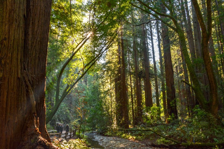
With the new parking reservation and shuttle system in effect, it can be really hard to see the majestic redwoods at Muir Woods National Monument, north of the Golden Gate, on a whim. If you don’t mind hiking 5-6 miles, there is another way: park at the Pan Toll or Bootjack parking lots in adjacent Mount Tamalpais State Park ($8) [note, these lots also get pretty busy by mid-morning]. The route linked here takes you down a forested hillside and onto the Muir Woods boardwalks, where you’ll see some truly spectacular old growth redwoods. In the winter and spring, the route is lush and green with plenty of running water. On the day we visited, we added some variety to the hike by exiting Muir Woods through the main entrance, walking down the main road, and taking the Dispea Trail uphill back to the car. The coastal views from this trail back were super!
Sunol Regional Wilderness, Sunol
- Rolling green hills
- Rocky canyons and waterfalls
- Dog-friendly
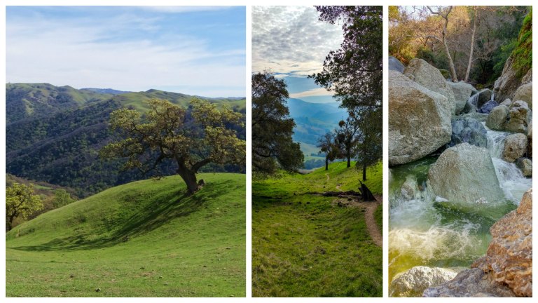
If you’ve ever made the trek to the top of Mission Peak, you have probably seen the beautiful hills and valleys to the east. This is Sunol Regional Wilderness, a gorgeous park that offers challenging peaks and more sweeping views and trails than its western neighbor. We’ve done the hike to the top of Flag Hill, which offers a set of steep switchbacks to views of the Calaveras Reservoir and some rocky formations with lots of oaks and green hills along the way. You could also hike out to Little Yosemite Valley to check out a rocky canyon and some nice little waterfalls (this trail gets pretty crowded near the rushing water, especially since there is a flat path out that is very family friendly). The park is also dog friendly, and you’ll see lots of pups along the way.
Wildcat Canyon Regional Park, Richmond
- Rolling green hills (one steep ascent)
- Peek-a-boo view of the San Pablo Reservoir
- Free parking
- Dog friendly
- Cows
- Windy
Despite its location just off the interstate in Richmond, it seems that this park is a bit of a hidden gem in the East Bay. Even at 11am on a beautiful sunny day, the free parking lot had plenty of space left! We took the 7.2 mile trail along the San Pablo Ridge, which offers amazing views of the Bay and the San Pablo Reservoir along rolling green hills. The steep ascent up to the ridge line is a bit demanding but doesn’t last very long and is followed by gentle rolling hills. Once you return to Wildcat Creek, the trail is paved and easy, and you’ll spot loads of vivid purple wildflowers trail-side. Note that even though the weather may seem ideal in the parking lot, the wind (and cold) can really pick up on the ridge, so pack an extra layer along with your sunscreen and water. The area is also an active cattle grazing area, and we saw lots of families of cows on the trail (bulls, mothers, and calves). Don’t get too close to avoid any aggressive advances.
What are some of your favorite hikes in the Bay Area? We’d love to have your input! Please leave your comments below or send us a message if you have any questions!

Great scenery!
LikeLike