

As we learn more and more about COVID-19, it seems like hiking outdoors is a relatively safe activity if you’re looking to get out of the house. In general, it is a good idea to seek out recreation near home: this limits the distance you have to travel and also the contact you may need with shared surfaces, like toilets.
This post is about a few hikes we’ve taken near us in the Bay Area where we found relative solitude and good conditions during the pandemic (they’re listed from south to north). At the end of the post, we talk about how we reduce our risk of transmitting or being infected with the coronavirus while we’re out on the trail.
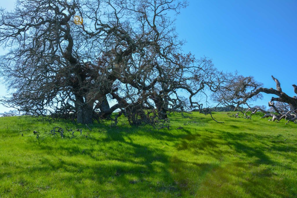
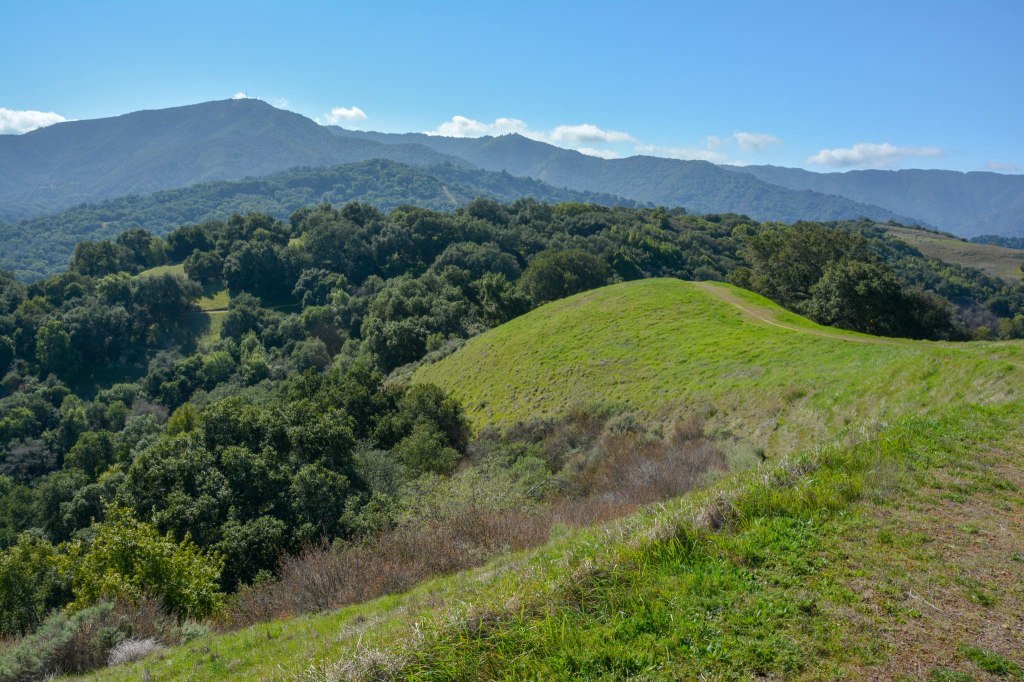
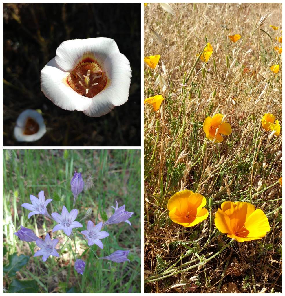
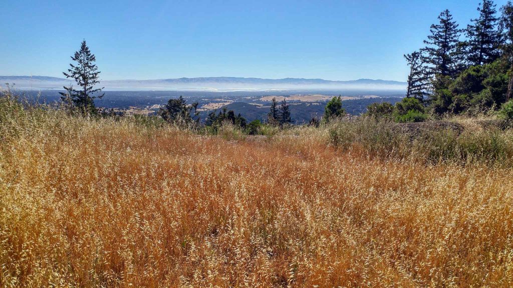
Rancho Canada del Oro, Morgan Hill
- Trail Map
- Rolling hills with panoramic views and wildflowers
- Long 1-way trail sections
We found out about this park from a friend, who found out about it through POST’s Hiking Calendar. We visited right before the pandemic and found no crowds on a sunny weekend afternoon! Since the pandemic started, the park has gotten busier, (the lot has had lots of space in the morning and none in the afternoon), so we’d definitely recommend coming early.
The park converted a number of trails to one-way, so we’d recommend starting out on Mayfair Ranch Trail and returning via Longwall Canyon, as we did on this 8-mile loop, which also went to the Bald Peaks. This whole hike is extremely beautiful, with green, grassy hills in the winter and lots of wildflowers later in the spring. There are gorgeous views out to Mount Umunhum and back into the Coyote Valley.
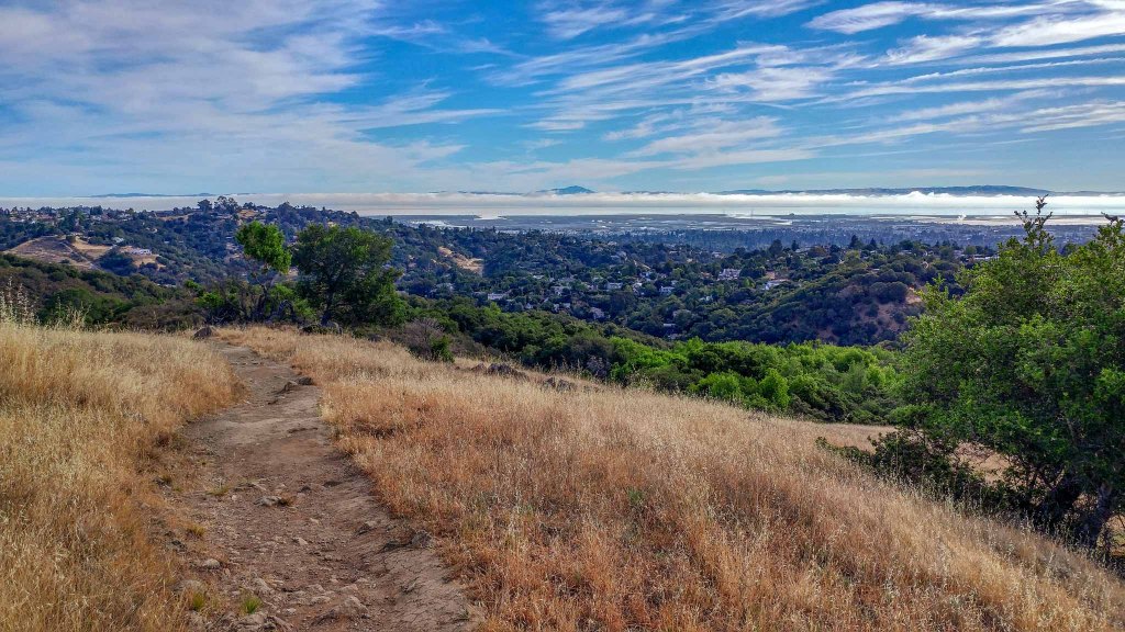
Fremont Older Open Space, Cupertino
- Trail Map
- Three scenic viewpoints
- Dog friendly
- Mostly two-way trails (with one nice one-way trail)
Fremont Older park is Cupertino is a well known because of its multi-use trails that are dog, bike, and horse friendly. The park can get pretty busy, so we arrived by 7:30AM to get started with our hike. We parked at Prospect Road, and the part of the trail right after the parking lots was the busiest. Friends have recommended parking at Regnart Road to encounter fewer crowds. We’ll try that next time.
We did a ~6-mile figure 8 hike, starting out towards Hunter’s Point and then went counter-clockwise, visiting Maisie’s Peak and Nob Hill before circling back. These vista points had very nice views, and we also enjoyed the one-way section of the pleasant, shady Seven Springs Loop.
Upper La Honda Creek Open Space, Skylonda
- Trail Map
- A grassy hike to open views and a very big sequoia
- A guaranteed way to avoid the crowds
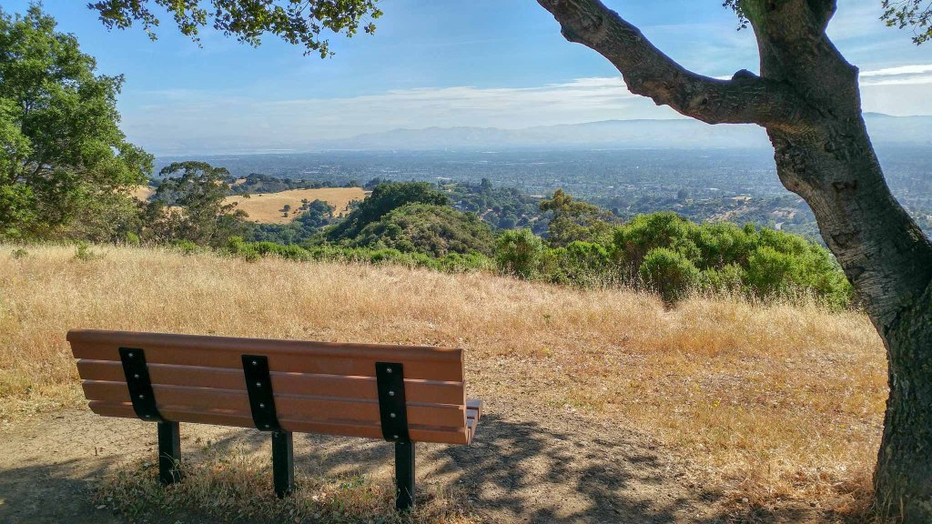
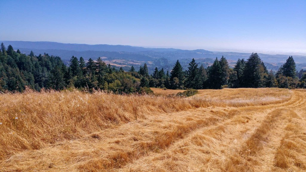
We talked about Lower La Honda Creek Open Space in another post, but this was our first time visiting the upper part of the preserve. The parking for this section is along a private road (Allen Road), so you need to apply for a free permit from the Midpeninsula Open Space District about 2-3 days before you head out. Because this area is limited to just 10 cars plus local hikers, you will run into very few people on the trail – we were the only car in the lot and encountered only 1 group of people when we went there! This is the place to go if you’re looking for a short hike with great views and plenty of solitude.
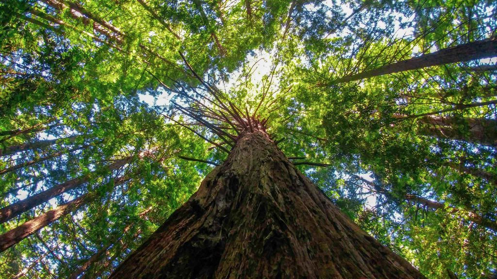
We covered all 4.7 miles of trail in the park, but after having experienced it, we’d instead recommend the 3.7 mile route in the map above, which goes counterclockwise along the Coho Vista and Cielo Trails, with side trips to the Vista Point for panoramic views of the hills and the Big Tree, a very impressive redwood. The views may have been better going clockwise, but the trail surface is basically crushed dry long grass, which made it a little too slick for steep downhills, in our opinion. And although this section of the park allows dogs, there is fox tail everywhere, so we would caution against that.
Wunderlich Park, Woodside
- Trail Map
- Mix of open meadows and walks in the woods
- Mostly wide, two-way trails
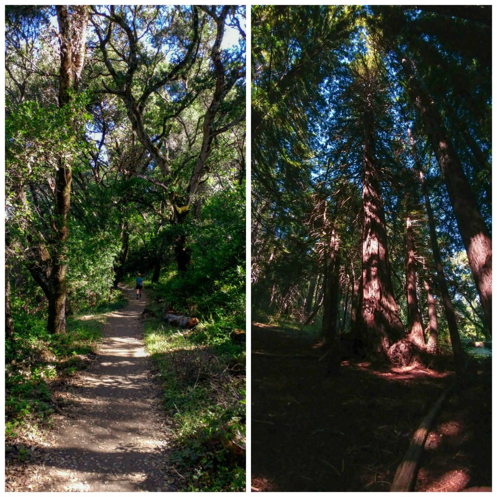
Wunderlich Park stands out as a really nice place to have a “walk in the woods,” both in oak chaparral and a beautiful redwood grove. The park opens at 8AM, and the parking lot fills up quickly: we visited on a weekday and found a spot, but by the end of the hike, people were already circling in the parking lot!
We did the 5-mile loop hike recommend by Bay Area Hiker. clockwise around the park, and most of the trails were reasonably wide. Two particularly interesting sections were the sections around Alambique Flat, which had expansive views across the Bay, and the amazing smell of redwood trees along the Redwood Trail.
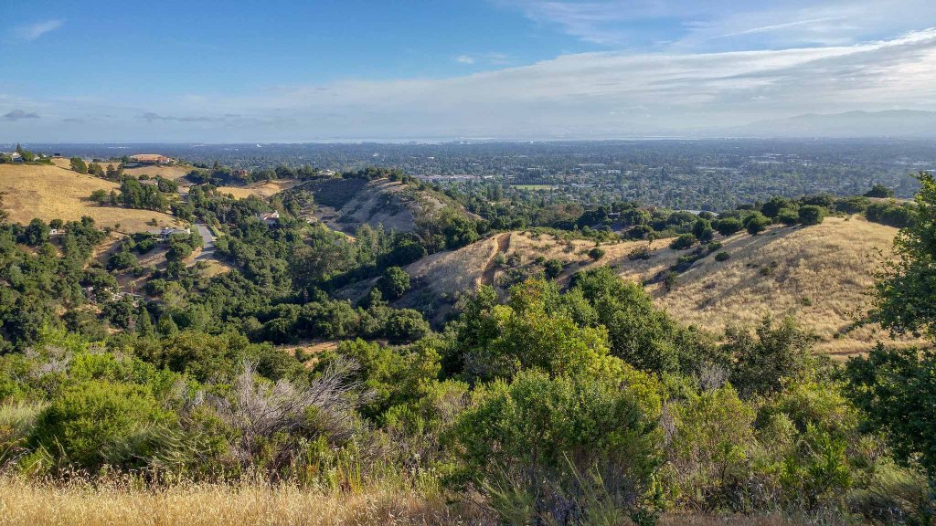
Edgewood County Park, Redwood City
- Trail Map
- Park close to 280
- Views of rolling hills and distant views of the Bay
- Mostly one-way trails
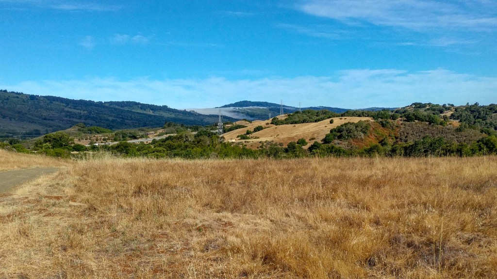
For driving, Edgewood County Park is extremely convenient, only a minute or two off on 280. The park opens at 8AM, and we’d strongly recommend getting there as early as possible.
We did a quick 4-mile loop clockwise around the outer edge of the park, mostly on one way trails. On the front half of the hike (Sylvan Trail), we got really nice views of the hills rising through the fog across the bay, and on the back half (Edgewood Trail), there were some nice views of the hills across Highway 280.
Tilden Regional Park, Berkeley
- Trail Map
- Reservoir and bay views
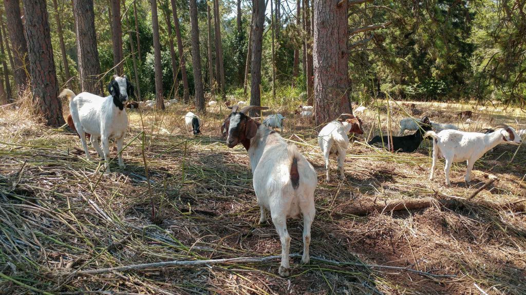
- Goats and eucalyptus trees
- Generally wide trails and high mask usage
Tilden is usually pretty busy because it offers lots of attractions, including a train, kids rides, and picnic areas. With many facilities closed during the pandemic, parking is readily available (and free) these days, even a little later in the day. We went to Tilden in the late morning on a weekday and we were able to park easily near the Quarry Picnic Site.
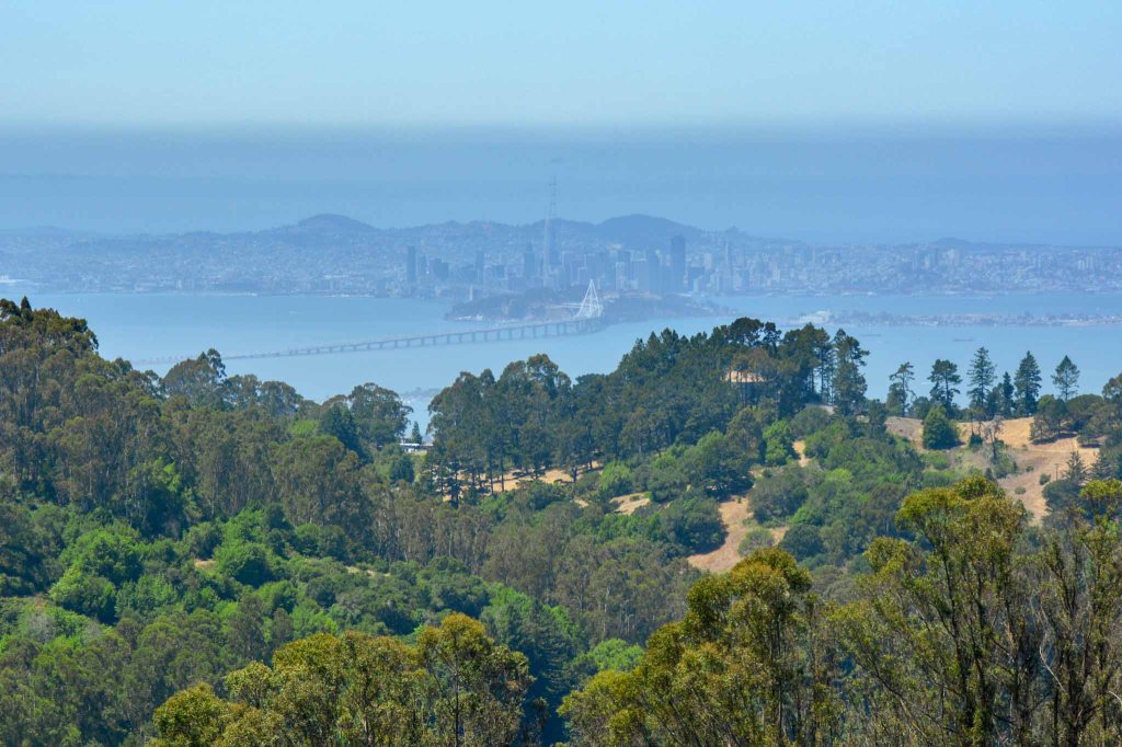
We did the Big Springs-Seaview Loop Trail (4.86 miles, ~2 hours). Most of the trails were wide, two-way trails, except a short narrow two-way section near the halfway point of the hike. The first half of the trail follows a ridge line through a pleasant Eucalyptus grove and then ascends up to Seaview Trail. When we visited, there were a ton of goats near the start of the trail! These animals help graze the grass and reduce the fire risk in the Berkeley Hills.
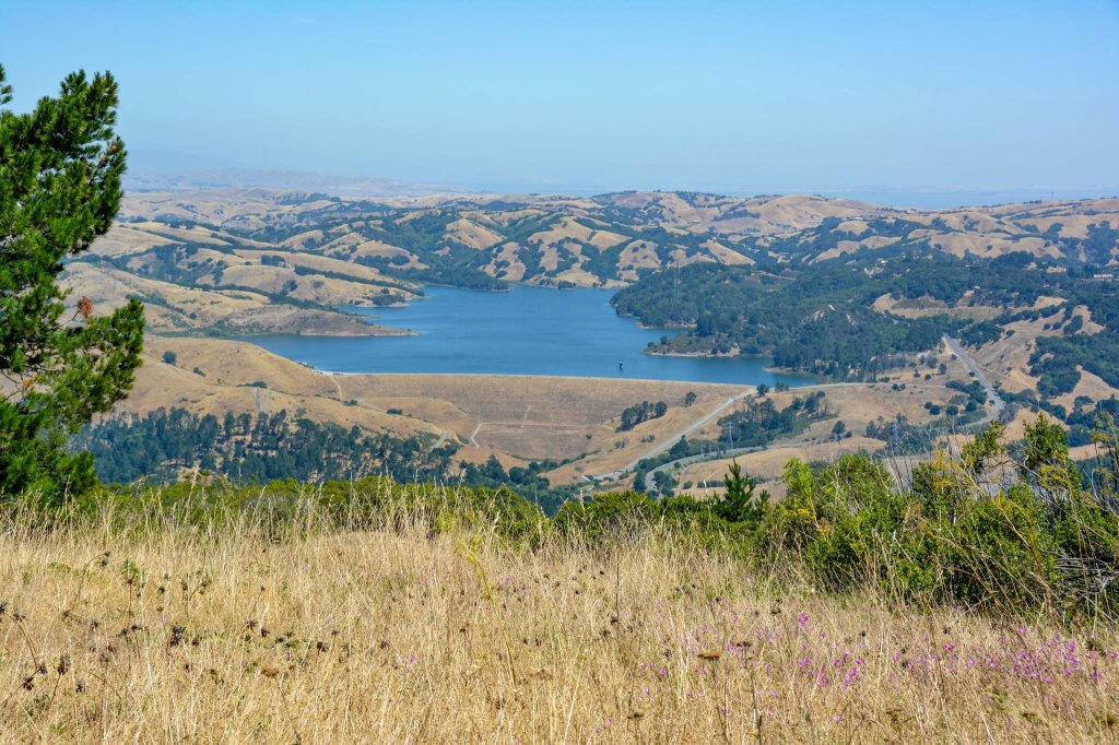
At about the halfway point, After the ascent, there is a small trail off to the left through some grass that connects to the Seaview Trail. The cutoff can be easy to miss, but taking it has a huge payoff: you immediately get an awesome view of the San Pablo Dam from the Briones Valley Viewpoint. Views of this valley, the Golden Gate Bridge, and the San Francisco Skyline continue all the way back to the parking lot.
Prevent the Spread – The 3 Ws

Wearing a mask can greatly reduce the transmission of the coronavirus. When hiking, we make sure that our masks are always easily accessible and put them on as soon as we see another hiking group approaching from the distance or if we’re going around a blind corner on the trail. We’ve sometimes had to wear a mask for over a mile on the trail; this is why finding a comfortable mask is really important. We’ve had good luck with multi-layered cotton masks like these, from Etsy. The pleats make it easy to talk, and the nose wire ensures a tight fit and prevents glasses from fogging up. If you’re hiking solo and don’t need to talk much, these masks from Tie Bar are really great: they also have a nose wire to ensure a good fit, wrap around the chin for a good seal, have adjustable ear loops, and also have a pocket for a filter. A filter made of Oly-fun fabric or even a folded Kleenex can greatly boost your masks’s effectiveness (according to recent work from Vijay’s PhD supervisor).
Washing your hands has been shown to reduce the risk of respiratory infections by 16% or more. It physically removes germs from your hands, thus preventing you from accidentally transferring them to your eyes, nose, and mouth, and detergents and solvents can also disrupt viral envelopes, rendering virus particles non-infectious. Washing up whenever you change locations or handle your mask is a good idea. Since it isn’t easy to have soap and water available on the trail, we each carry hand sanitizer in an easy to access place, like attached to a belt buckle or bag. There was some worry that keeping alcohol-based sanitizer in your car could cause a fire, but remembering to carry sanitizer is still very important.
Watching your distance can be one of the most important but also one of the trickiest things to do when hiking during the pandemic. With outdoor recreation being one of the only outlets for people to have fun, and with many people on more flexible schedules, we found full parking lots and trails even in the middle of the week. In general, going right when a park opens during a weekday has worked well for us. We also use Google Maps graphs to estimate how busy parks typically get during the day. Once on the trail, many parks offer wide trails and one-way trails, making it easier to keep apart. See, for example, this list from Santa Clara County.
Where have you found some solitude and fresh air during the pandemic? Do you have any tips for staying safe on the trail? Leave your thoughts below!

Nice photos
LikeLike